L&T Group Websites
- Corporate
- Corporate – Arabic
- CarbonLite Solutions
- GreenTech
- Heavy Engineering
- Hydrocarbon
- LTIMindtree
- L&T Construction
- L&T Construction & Mining Machinery
- L&T Finance
- L&T Howden
- L&T Hydraulics
- L&T Infrastructure Finance Company Limited
- L&T Institute of Project Management
- L&T Technology Services
- L&T Kuwait Construction
- L&T MBDA Missile Systems Limited
- L&T Metro Rail (Hyderabad) Limited
- L&T-MHI Power Boilers
- L&T-MHI Power Turbine Generators
- L&T Precision Engineering and Systems
- L&T Realty
- L&T-Sargent & Lundy Limited
- L&T Special Steels and Heavy Forgings
- L&T-SuFin
- L&T Valves Limited
- Nabha Power Limited
- L&T Public Charitable Trust
- Rubber Processing Machinery
- Shipbuilding
- L&T Skill Trainers Academy
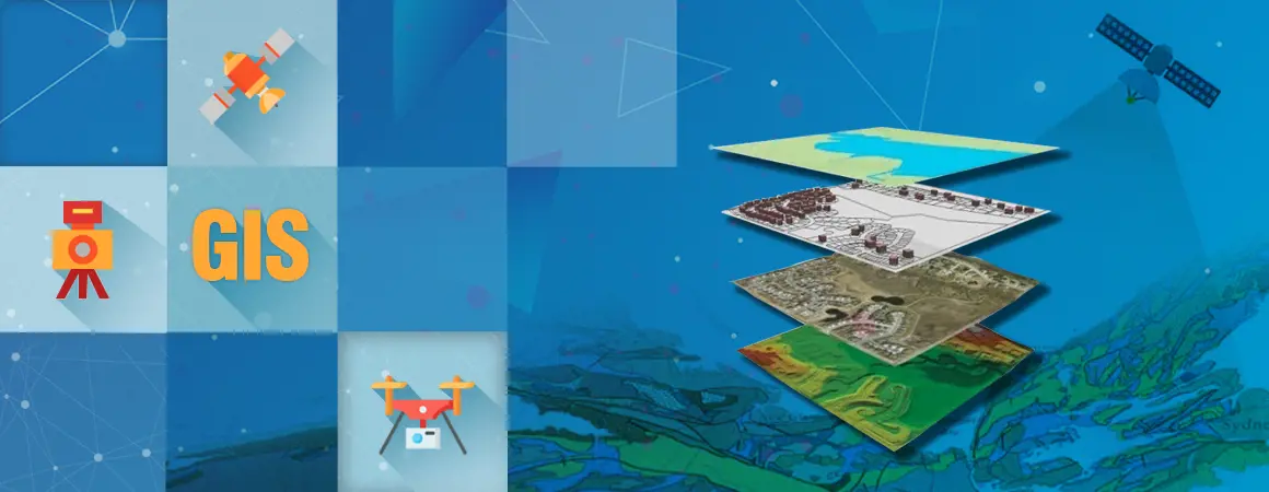
Geospatial Technology
Geospatial technologies make traditional forms of site surveying redundant, making access to quicker and more accurate data possible. Through geospatial technologies such as GPS/GNSS, LiDAR, Photogrammetry, satellite remote sensing and the like, data is acquired, manipulated, stored, analyzed and presented at project sites across the various businesses of L&T Construction.
Real-time surveying does not require post processing and its popularity lies in its simplicity, quickness, accuracy and elimination of all human error.
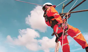
LiDAR is an active remote sensing technology, using its own source of energy to emit millions of laser beams and based on their reflection, create a point cloud to measure co-ordinates of objects in 3D. LiDARs can be terrestrial when placed on a tripod or stand on the ground or mobile when placed on a vehicle. The technology has been used at several sites including the Statue of Unity, the Bar-Bilara-Jodhpur road project, as well as at smart city projects in Nagpur, the surveillance system in Mumbai and the CSITMS in Hyderabad.
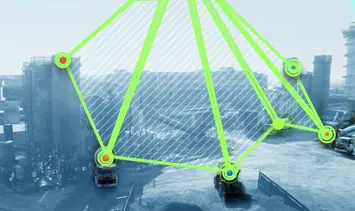
Drone-based Photogrammetry is equally effective and works best for road projects. In linear road projects, large tracts of the terrain can be quickly and accurately surveyed with the added advantage of extrapolation and reuse of data. Drone-based Photogrammetry has been used at the Dholera SIR (Special Investment Region) site in Gujarat and the DFCC Projects for the Eastern and Western corridors.
Stereo satellite imaging processing is another method employed at several L&T projects sites and real-time Kinematic GNSS and Integrated GNSS-based Positioning & Monitoring Solutions are being used at the dedicated freight corridor sites. Real-time surveying does not require post-processing and its popularity lies in its simplicity, quickness, accuracy and elimination of all human error. It is most handy when executing locations near the sea for it enables automatic stakeout of pile locations on the coast.
GIS-based Radar Elevation Data Processing is another geospatial technology employed at some sites by our Power Transmission & Distribution business, most notably at Transmission Line projects in Kenya, Malaysia and Botswana.
An x-ray vision to see what lies beneath the surface.
Digitalization can play a vital role in Water & Effluent Treatment projects, in areas such as supply, treatment, distribution and conservation where much of the work involves trenching and often we have to literally dig ‘blind’ because there are no records available of the existing underground utilities. Geospatial technologies such as GPR (Ground Penetrating Radar) provide an ‘x-ray vision’ to see what lies beneath the surface before we start work.
Water utilities recognize GIS as an authoritative repository of asset information that can be shared throughout the entire utility and integrated with other systems like SCADA. The integration of GIS, IT (Information Technology) and SCADA systems, has made a significant impact on information dissemination, mapping information resources on to real-world visualizations, that has resulted in the development of integrated enterprise-level Geographical Information Systems for Water Utilities Management.
In the realm of smart world solutions, asset management of CCTV implementation is now possible using web-based GIS, as we have done for the Gujarat Intelligent Traffic Management System, which integrates the NMS (Network Management System) and the VTMS (Vehicle Tracking Management System) with asset information from the cameras. All the camera locations are mapped using GIS technology and the asset information pertaining to every camera is fed into the GIS. By integrating NMS with the GIS, faulty cameras can be identified when displayed on GIS maps with geographic perspectives along with the details of the fault. Likewise, integration of VTMS with GIS will support the dispatching team to rectify the faulty cameras and other assets by implementing routing analysis and Geo-fencing concepts.
Perhaps the most valuable asset to arise from the adoption of these technologies is the Reusability of data. L&T’s GeoData bank is a blend of geographic understanding, management practices, engineering & information technology that help to effectively re-use spatial data that has been captured/bought for earlier projects.